Navionics CF/1G904XL3 Marine Chart Map

Best navigation tool for Northeast coastal and offshore anglers.
This is the essential upgrade for navigating the complex Northeast coastline and offshore canyons with precision. While it relies on older Compact Flash technology, it remains the gold standard for reliable, deep-water bathymetric data on legacy chartplotters that simply refuse to quit.
$149.95
at
Second Wind Sales
Who it's for
- Long-distance cruisers needing seamless, expansive coastal navigation data
- Anglers and mariners requiring precise depth and structure details
- Boaters who value crowdsourced, up-to-date local navigation insights
Who should skip it
- Owners of modern chartplotters with only microSD card slots
- Budget-conscious sailors avoiding recurring annual subscription fees
- Travelers planning voyages beyond the pre-defined regional map boundaries
Performance breakdown
Geographic Coverage
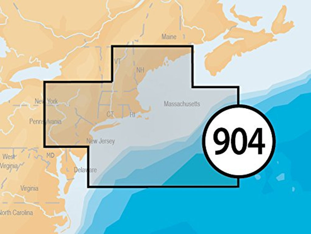
Extensive regional mapping spans from Maine down to the offshore canyons.
Bathymetric Detail
High-resolution depth data provides critical insight for safe offshore navigation.
Hardware Compatibility
Reliable performance on legacy Raymarine and Northstar chartplotter systems.
Installation Simplicity
Plug-and-play Compact Flash format ensures immediate access to navigational data.
Data Reliability
Trusted Navionics mapping standards offer consistent accuracy for coastal waters.
System Integration
Seamlessly overlays essential chart information onto older marine display interfaces.
Key Specs
Format
CF Compact Flash Card
Area
US Northeast and Canyons
Coverage
Maine, Massachusetts, New York, Hudson River, North Atlantic Canyons; From Passamaquoddy Bay and Grand Manan Island to Shark River Inlet, including Hudson River to New York State Barge Canal to Lake Ontario, Oneida Lake, The Finger Lakes, Lake Champlain and bathymetric details of all North Atlantic Canyons from Delaware Bay offshore to Georges Bank and East to 64°: West.
Compatibility
Raymarine C70, C80, C120, E80, E120, Northstar 6000i, 6100i, and many more
Manufacturer
Navionics
Part Number
CF/1G904XL3, 1G904XL3
Know before you buy
Still have a question?
Ask Metto anything about the Navionics CF/1G904XL3 Marine Chart Map before you decide.