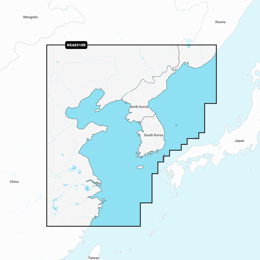
Garmin Navionics+ Marine Chart

Best navigation tool for mariners exploring the Yellow Sea.
This is the definitive navigation upgrade for anyone tackling the Yellow Sea. By merging Navionics’ legendary detail with Garmin’s intuitive routing, it removes the guesswork from complex coastal waters. You sacrifice the simplicity of a basic paper map, but you gain the precision of automated, real-time depth intelligence.
$123.74
Who it's for
- Anglers and navigators needing precise depth data for coastal safety
- Mariners requiring the latest hazard data for safe passage
- Captains seeking automated routing and real-time custom mapping tools
Who should skip it
- Owners preferring one-time purchases over ongoing annual subscription fees
- Budget-conscious boaters looking for affordable regional navigation solutions
- Voyagers planning long-distance trips across multiple international maritime regions
Performance breakdown
Navigation Precision
Auto Guidance+ technology delivers highly reliable route suggestions for complex coastal waters.
Data Freshness
Daily chart updates via ActiveCaptain ensure your navigation data remains current.
Bathymetric Detail
One-foot contours provide exceptional clarity for identifying underwater structure and fishing spots.
Interface Integration
The streamlined Navionics style interface feels intuitive on compatible Garmin chartplotters.
Installation Ease
Plug-and-play MicroSD card format makes setup effortless for any marine user.
Community Connectivity
ActiveCaptain integration offers valuable crowdsourced insights from fellow mariners nearby.
Key Specs
Format
MicroSD/SD Card
Weight
0.1 lb
Brand
Garmin
Model Number
GAR-010-C1216-20
Certifications
NMEA Certified, ABYC Certified
Chart Coverage
Yellow Sea area
Firmware Updatable
Yes
Network Compatibility
ActiveCaptain
Know before you buy
Still have a question?
Ask Metto anything about the Garmin Navionics+ Marine Chart before you decide.